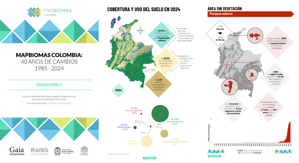
Download the document that compiles the main aspects of the data from the land use and land cover maps of Collection 3 of MapBiomas Colombia.
Access the report in figures for Collection 3 of MapBiomas Colombia
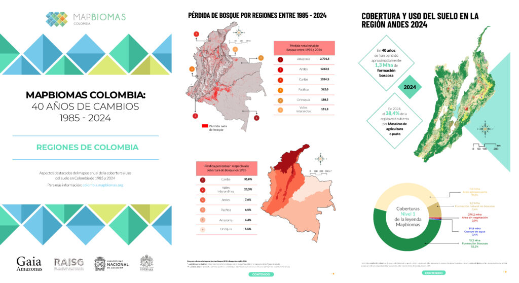
HIGHLIGHTS BY REGIONS
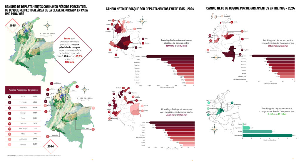
HIGHLIGHTS BY DEPARTAMENTS
Access the report by departaments
MAPBIOMAS WATER COLOMBIA– COLLECTION 3 3
Access the water dynamics report
Access the glacier dynamics report
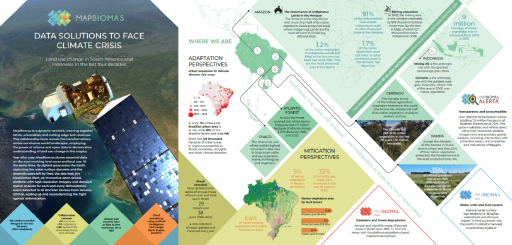
DATA SOLUTIONS TO FACE THE CLIMATE CRISIS
Access the figures report from the MapBiomas Network